





Xona Space Systems

100 times stronger than their GPS counterparts
(All images: Xona Space Systems)
Guiding the way
Xona Space Systems is developing next-generation satellite navigational intelligence systems to enhance commercial GPS. Chris Young explains
Pulsars, rapidly rotating neutron stars, are often compared to cosmic lighthouses because of their remarkably regular pulses of electromagnetic radiation. Experiments have even shown they can function as naturally made GPS satellites – a spacecraft can use these precise pulses to determine its exact location based on tiny differences in their arrival time.
Aptly, Xona Space Systems has named its upcoming satellite constellation Pulsar. Founded by a group of Stanford engineers in 2019, Xona’s core idea is that the infrastructure underpinning GPS and global GNSS was not built for a connected, autonomous world. To tackle this problem, Xona is building a next-generation location services network that maintains extreme timekeeping precision from LEO using a distributed clock system.
The aerospace startup, with headquarters in Burlingame, California, as well as London and Montreal, obtained a first-of-its-kind FCC approval to operate its satellites in the same L-band spectrum as GPS. This means its service will work with existing chipsets and hardware, making it accessible with only a software update.
Flying in LEO as opposed to the traditional MEO GPS orbit is key because, as Tyler Reid co-founder and CTO of Xona Space Systems tells us, that added proximity allows for a signal that is “100 times stronger. That makes us much more resilient to jamming. And our extensive testing with our satellite in orbit shows that our signal works in many places that GPS does not reach.”
From Huginn to Pulsar
On August 3, 2026, Xona received FCC authorisation to broadcast commercial navigation signals from its planned LEO constellation of 258 satellites. The authorisation initially permits deployment of 16 spacecraft, with further approval subject to an updated orbital-debris assessment and deployment milestones. This makes it the first private company allowed to operate in the L-band spectrum adjacent to GNSS and GPS.. According to Xona, “This authorisation marks the last regulatory milestone needed to advance Pulsar from demonstration to scaled deployment.”
Xona’s two technology demonstration missions, Huginn and Pulsar-0, were key to obtaining the all-important FCC authorisation. Together, they demonstrated that Xona’s satellites could provide stronger signals without interfering with GPS, aviation safety systems and other global navigation services.
The first mission, Huginn, launched aboard SpaceX’s Transporter-5 mission in May 2022, took it from concept to orbit in the space of 12 months. According to Xona, this made it the first American private company to fly a satellite navigation mission.
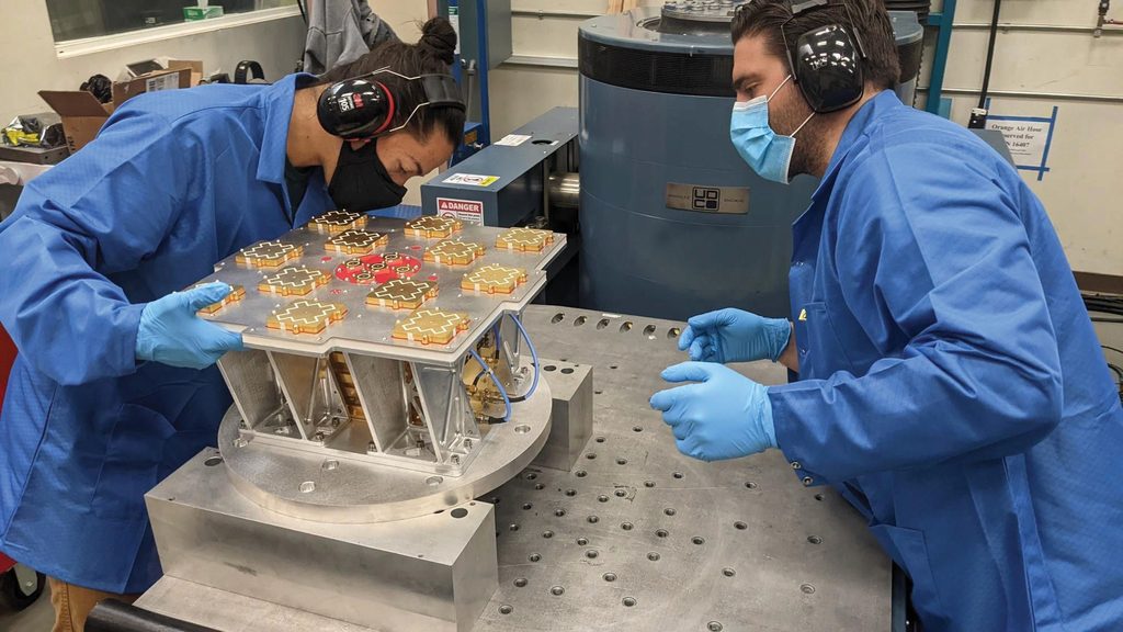
“The first step was to show that a startup like us can build the technology that would enable these kinds of navigation capabilities in orbit,” Reid explains. “This was one of the biggest things that we were coming up against in the early days of the company: GPS satellites cost $250 million, not including the launch cost. Could we really do this for a million dollars?”
Xona turned to technologies that were making space applications more accessible. These included FPGA-based tools and RFSoCs to generate and test their signals in real time, as well as adopting software-defined radios.
“We really focused on the payload part, as we really had to prove our new space way of tackling the navigation side of things,” Reid continues. “And that mission did what we wanted it to do, which was to show that we can generate precision navigation signals in orbit, track them on the ground, and trace that back to show that you can get the kind of precision and synchronisation that is fundamentally needed from a navigation system like this.”
During Transporter-5, Huginn was one of many payloads hosted within Spaceflight Inc.’s Sherpa-AC orbital transfer vehicle. This meant that Xona simply didn’t have as much time operating their payload as they would have liked, Reid tells us.
Still, Huginn successfully paved the way for Xona’s first production-class satellite. For Pulsar-0, Xona partnered with Belgian firm Aerospacelab to develop the first satellite in its planned Pulsar constellation. Pulsar-0 was built around Aerospacelab’s VSP-150, a 150 kg modular LEO satellite platform. Aerospacelab supplied the satellite bus and integration, while Xona supplied the specialised positioning, navigation and timing (PNT) payload.
With Huginn, Xona learned that C-band signals were more challenging than initially anticipated for manufacturers to integrate into existing equipment. They were also less jamming-resistant than expected. So, for Pulsar-0, Xona set the C-band aside and focused its efforts on the L-band. Prior to launch, it invested a great deal of time into identifying portions of the spectrum to develop its X1 and X5 signals.
Xona also turned to increasingly accessible advanced FPGAs capable of performing direct digital synthesis of the entire signal. This allowed the team to create navigation signals entirely with maths, making them more predictable and precise – a key advantage when compared with analogue circuits, whose performance can change with temperature, time and other variables.

To boost the power and availability of its signal, the team also upgraded its antenna. Xona claims it was a first-of-its-kind upgrade because no other company at the time was transmitting a Radio Navigation Satellite System signal at these power levels from an LEO satellite – much less in an isoflux antenna pattern, which transmits constant power to the end user while the satellite is overhead.
In this case, Xona wasn’t able to rely on off-the-shelf components. Instead, it built what it describes as an antenna tailor-made for its end user, resulting in “the best possible PNT performance for the modern era.” On its website, Xona states that Pulsar provides a received signal power of up to −136 dBW, approximately 100 times the received power of GPS L1 C/A.
Interestingly, Xona decided not to include a propulsion system in Pulsar-0 because of supply-chain and schedule considerations. Although that reduced the spacecraft’s planned mission capability and lifetime, it meant Pulsar-0 was ready to launch on Transporter-14.
The Pulsar-0 mission flew to LEO in June 2025. FCC authorisation for the Pulsar-0 satellite specified an orbital altitude of 510 ±15 km – the final operational constellation will fly at ~1080 km.
“This was an extremely successful mission for us,” Reid says. “Having a dedicated spacecraft where we could do multiple passes in multiple places around the world a day really was a huge unlock for us to be able to iterate quickly and make faster progress.”
In its first year, Pulsar-0 performed more than 350 individual tests in four continents with over a dozen receiver partners. It collected 22 TB of GNSS observability data during this period. In live-sky jamming tests, Xona demonstrated Pulsar reception under intense radiofrequency interference where GPS was unavailable. According to Reid, testing showed its signal design can reduce a jammer’s effective area by 95%.
Pulsar also demonstrated centimetre-level native positioning performance, with on-orbit software updates since launch improving its native positioning accuracy by more than 2.8 times. This moved it from a 4.2 cm ranging error to a best result of 1.5 cm native accuracy. Together, Huginn and Pulsar-0 demonstrated that Xona’s technology could work and was ready for commercial service.
At the time of writing, Xona is overseeing its next big milestone: the launch of six more production-class satellites aboard SpaceX’s Falcon 9 rocket on the Transporter-18 mission on October 1, 2026. Aerospacelab manufactured four of those, while the other two were assembled in Xona’s primary facility in Burlingame, California.
Xona’s clean-sheet design
Beyond its Pulsar launches and FCC approval, Xona’s most important recent marker is its move toward manufacturing satellites in-house. This serves as a direct step toward scaling from experimental missions to full commercial deployment.
Aerospacelab has served as a transition manufacturing partner for Xona. The company’s new in-house satellites, which are based on a clean-sheet design, are tailored more specifically to Xona’s navigational needs. “They are different in the sense that the layout of the bus itself is optimised around our specific navigation mission,” Reid explains. “So, the satellite buses do look quite different but the payload fundamentally is very similar between the two.
“Xona’s clean-sheet design is about building a satellite to serve a PNT mission from the jump versus retrofitting a generic satellite actually optimised for a telecom or earth observation mission. Our PNT mission requires operational flexibility, manufacturing at scale and unique technological abilities. A quick example of how we’re achieving those mission requirements via design is our PNT antenna. We adjusted the bus geometry, moving the antenna to a location that prevents self-interference, while also simplifying the design in the process. This simplicity also resulted in something much less expensive to manufacture at the scale we need.”
Xona is manufaturing these new satellites at its Burlingame facility, which it says was made possible by its $170 million Series C funding round announced in March. The facility serves as an integration and assembly site, and Xona CEO Brian Manning has publicly stated that it is designed to build two to three satellites per week. “We’re taking a lot of lessons learned from the new space arena of how you manufacture satellites in that assembly-line fashion that is similar to how you would assemble a car,” Reid notes, adding that this is a departure from the highly curated process of building GNSS satellites.
Growing threat of spoofing
From their inception, the GPS services that transformed modern society were reliant on ageing hardware. By the time the US government ended Selective Availability on May 1, 2000 – removing the intentional degradation of civilian GPS signals and making high-accuracy positioning widely available – parts of the system’s underlying technology were already decades old.
Now that the world is accelerating toward autonomy, traditional positioning systems are showing their limitations. Reid, who worked as a research engineer at Ford Motor Company before co-founding Xona in 2019, says this is most evident in the world of autonomous vehicles. To reach Level 5 autonomy, these require real-time localisation accurate to within 10 cm – orders of magnitude higher than traditional GPS can provide.
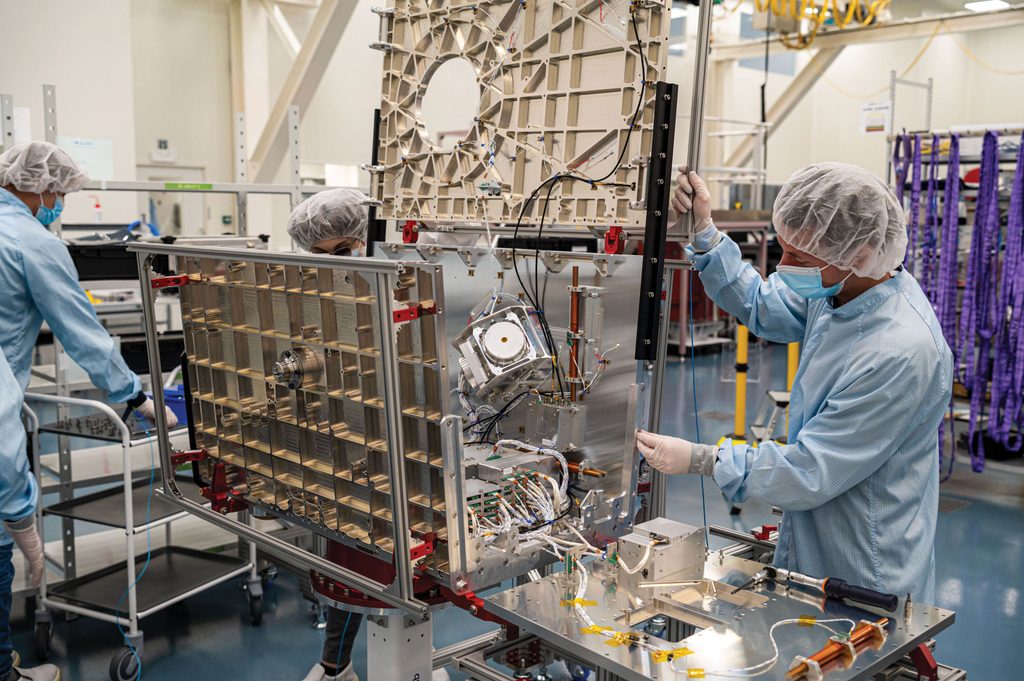
Beyond the required precision, the open, publicly documented civilian GPS signal structure creates a slew of safety concerns. These include hacking that can lead to a car being purposefully driven off the road or even crashed.
But first, let’s backtrack a little to Pokémon Go. Yes, that’s right! When the mobile game launched and became an overnight success in July 2016, some users were so desperate to catch a rare Pokémon within the AR location-based mobile game that they put themselves in compromising situations. Others turned to spoofing. The ease at which they did so served as a wake-up call for many within the GPS community.
“The Pokémon Go example is just one of the things that really shook the broader community,” Reid says. Up to that point, there had been just a handful of academics and nation states that had shown they can spoof GPS. “In the case of GPS, the civilian signals that we use are not encrypted – they’re not authenticated, they’re just open. And, in the 1970s, that made sense because synthesising fake GPS signals was something that was very complicated to do.
“With Pokémon Go, we realised that with a roughly $100 software-defined radio – the kind of thing you can buy on Amazon – and some open-source code someone developed and put on GitHub, you can have a very effective GPS spoofer in a matter of minutes,” Reid continues.
“That’s fine if you’re cheating at Pokémon Go, but what really impacted me was seeing that same set-up used to do targeted attacks on some of the emerging self-driving cars at the time, and seeing them not just lose their way but also perform dangerous manoeuvres.”
Safeguarding
Ironically, Xona found that the technological innovations that were making GPS spoofing accessible could also help them realise their vision and safeguard against these practices. Software-defined radios, in particular, play an important role in Xona’s Pulsar technology.
According to Reid, the biggest spoofing threats have presented themselves since the founding of Xona. Beyond autonomy and aviation, hackers have also used spoofing to target critical infrastructure. The Xona CTO claimed there is a lack of public awareness regarding this threat.

“GPS fundamentally is a time transfer system from space,” he says. “So, it’s a big clock in the sky sending signals to the ground and all of our infrastructure relies on it. That includes everything from synchronising the power grid to telecom cell towers, to data centres and financial transactions.”
Jamming and spoofing activity is also prevalent in conflict zones like Ukraine, where it is used as a form of electronic warfare. Targeted, fake GPS signals, for example, can disrupt users over a wide area.
“Fundamentally, there are two layers we are using to protect users against spoofing,” Reid states. “One is at the data layer and the other is at the measurement layer.”
Xona puts an authentication layer on the data layer, which protects against one type of spoofing attack. It leverages a few different security techniques to do so, according to Reid, who notes that these should be familiar to cybersecurity operators.
“The second layer, which we call range authentication, is at the measurement level,” Reid continues. “So, when you’re doing that range measurement to that satellite, how do you authenticate that part? This is a bit trickier because you have to calculate that range, and what you are doing is tracking a very fine modulation on the signal. The way we authenticate that is we randomly change a few bits in that fine modulation. Only someone who knows the secret can unscramble and make sure those bits were flipped in the right place.”
Toward a fully connected, autonomous world
While Reid was at working at Ford, he also served as a technology scout. This entailed “seeing startups coming through the door, pitching new technologies and techniques to support Ford’s autonomous vehicles.”
Reid came at the task with a background in GPS technology – his PhD thesis was written on improving GNSS systems (such as GPS) by flying in different orbits. “Navigation was a fundamental piece of making those systems work, but there wasn’t really one thing meeting all of the needs,” he says.
The Xona CTO thinks, “If we could just tweak a few things about GPS, this could really be the rising tide that lifts all ships. If we could invest in space infrastructure, that could make these vehicles more accessible. So, that got the wheel spinning for me and that led to reaching out to the other co-founders and, eventually, we quit our jobs and formed Xona.”
Ultimately, the company sees its next-generation navigational intelligence system as complementing rather than replacing GPS. “For a commercial player to come in and try to operate in the GNSS spectrum bands, this was very much uncharted territory,” Reid notes.

“We’re trying to build a system that can add more capability, not replace or displace performance for the end user,” Reid adds. “You can see that in a few of the design decisions we’ve made. One is on the spectrum side, related to the FCC license. It means that we work with the same hardware that GNSS works with today – the same antennas, the same RF front end, the same receiver chips. And devices only need a firmware upgrade to make use of the Xona signals and have that expanded capability.”
How to replace an atomic clock
Surprisingly, Xona provides that expanded capability by removing one of the most complex components of a GPS satellite: the atomic clock. GPS and GNSS satellites use lightweight but costly atomic clocks to provide extremely precise timekeeping for years at a time. These clocks measure the resonant frequency of atoms, providing the extreme precision required for GPS.
To provide its navigational capabilities at a fraction of the cost of GPS, Xona’s Pulsar network uses a distributed clock system that leverages inter-satellite links (ISLs). For reference, China began demonstrating the feasibility of ISLs in orbit in 2015 through experimental BeiDou-3 navigation satellites that used Ka-band ISLs for inter-satellite ranging, time synchronisation and autonomous navigation. “Our distributed clock technology is analogous to a cloud solution, whereas GPS is like an on-prem solution,” Reid explains. “With all of these radio navigation systems from space, whether it be GPS or Xona, they’re all leveraging heigh time synchronisation – to determine your position, what you’re actually measuring is time.”
Essentially, a GPS satellite sends a signal containing a precise time stamp. The signal takes some time to reach the receiver. By comparing the signal’s transmission time with the time it was received (and multiplying it by the speed of light), the receiver can estimate how far away the satellite is. If the receiver also knows the satellites’ positions, it can determine its own location by combining measurements from several satellites.
“To give you a sense of how tight that time needs to be, we’re talking nanosecond timing or even better,” Reid says. “When you scale a nanosecond by the speed of light, that gets you to an accuracy of 30 cm. So, if you’re trying to get into that sub-metre territory, these are the kind of numbers we’re talking about.
“GPS solves that with atomic clocks that have bespoke, high-end frequency standards on board that drift very slowly with time. That keeps a very tight synchronisation across those satellites, using very precise onboard clocks. That method works, as shown by the fact we all use GPS today.”
The issue is that this requires highly complex hardware, resulting in satellites that cost hundreds of millions of dollars. Xona addresses this in a number of ways. One advantage it has is that its satellites fly in LEO, meaning they are roughly 20 times closer than GPS satellites in MEO. Many MEO orbits intersect regions of the outer Van Allen radiation belt – a harsh environment that requires costly radiation-tolerant hardware.
“Being in LEO is a very different radiation environment, which allows us to use a lot of off-the-shelf technology,” Reid says. One example is Oven Controlled Crystal Oscillators (OCXOs), which provide synchronisation capabilities at lower cost.
Many GNSS satellites use OCXOs in combination with atomic clocks. An OCXO keeps a quartz crystal at a steady, warm temperature inside an ‘oven’ to provide short-term stability and generate the high-frequency radio signals required. However, pure quartz crystals drift over time because of ageing and temperature changes. To counter this, the OCXO provides the immediate stable radio frequency, while the atomic clock continually corrects the crystal’s long-term drift.
For Pulsar, Xona leveraged OCXOs while removing atomic clocks from the equation. Reid explains, “The way we can get away with doing that is we’re leveraging ISLs to keep the synchronisation between the satellites in a more real-time sense. We can do that because we have a different set of requirements than GPS satellites, which are fundamentally military assets and have to be able to work in certain conditions that require this individual clock synchronisation capability.

“By leveraging those ISLs, we can link the satellites together, maintain synchronisation across them and then link back to different nodes on the ground,” he continues. “This allows us to keep that synchronisation as a system with respect to traceability to the universal time systems that we all use today.”
Xona’s integrated systems in the sky reflect the network it is building on the ground. Huginn, the first batch of Pulsar satellites and the company’s California facility indicate a clear progression. The company has proven its payload, validated it through extensive orbital testing and is now scaling its manufacturing capability. It aims to roll out its initial commercial service in 2027.
“Thinking about next year,” Reid says, “we’re just excited about the opportunity to transition from showing that this is a technology that hits the benchmarks and can perform in these environments, to starting to offer those first services to our first customers.”
UPCOMING EVENTS